Bengaluru [ˈbæŋgəloːɾ], officially Bengaluru (Kannada: ಬೆಂಗಳೂರು, ['beŋgəɭuːɾu], is the capital of the Indian state of Karnataka. The name Bangalore is an anglicised version of the city's name in the Kannada language, Bengaluru.
On October 7, 2006, the Government of Karnataka decided to officially implement the name change on November. 1, 2006.
Overview: People & Place[]
Map[]
People[]
Bangalore has an estimated metropolitan population of 6.5 million (65 lakh), making it India's third-largest city and fifth-largest metropolitan area.
Place[]
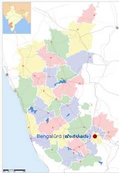
Karnataka showing Bangalore
Located on the Deccan Plateau in the south-eastern part of Karnataka, Bangalore is India's third most populous city and fifth-most populous urban agglomeration.
History[]
A written history of continuous settlement exists only from 1537. In that year, Kempe Gowda I, whom many regard as the architect of modern Bangalore, built a mud fort in the city and established it as a province of the Vijayanagara Empire.
During the British Raj, Bangalore developed as a centre for colonial rule in South India. The establishment of the Bangalore Cantonment brought in large numbers of migrants from Tamil Nadu, Andhra Pradesh and North India for developing and maintaining the infrastructure of the cantonment.
Geography[]
Bangalore is situated in the southeast of the South Indian state of Karnataka. It is located in the heart of the Mysore Plateau (a region of the larger Precambrian Deccan Plateau) at an average elevation of 920 m (3,018 feet).
Culture[]
Economics[]
Politics & Administration[]
Politics[]
Administration[]
The Bangalore Mahanagara Palike (BMP, Bangalore Metropolitan Council) is the municipal corporation in charge of the civic and infrastructural assets of the city. The district of Bangalore is home to seven other city municipal councils such as those in Yelahanka, Bommanahalli, Dasarahalli, Krishnarajapuram, Pattangere, Bytarayanpura and Mahadevapura. The Government of Karnataka proposes to merge these seven councils into BMP to form Greater Bangalore.
The BMP council comprises 100 elected representatives, called "corporators", one from each of the 100 wards (localities) of the city. Elections to the council are held once every five years, with results being decided by popular vote.
A mayor and commissioner of the council are also elected through a quota system from a Scheduled Castes and Tribes candidate or to an Other Backward Class female candidate.
See also[]
Trivia[]
No major rivers run through the city, though the Arkavathi and South Pennar cross paths at the Nandi Hills, 60 km (37 mi.) to the north. River Vrishabhavathi, a minor tributary of the Arkavathi, arises within the city at Basavanagudi and flows through the city.
The rivers Arkavathi and Vrishabhavathi together carry much of Bangalore's sewage. A sewerage system, constructed in 1922, covers 215 km² (133 mi²) of the city and connects with five sewage treatment centers located in the periphery of Bangalore.
Traffic[]
The BMP has been criticised by the Karnataka High Court, citizens and corporations for failing to effectively address the crumbling road and traffic infrastructure of Bangalore. The unplanned nature of growth in the city resulted in massive traffic gridlocks that the municipality attempted to ease by constructing a flyover system and by imposing one-way traffic systems.
Photo gallery[]
External resources[]
Everything else[]
|
If you want to add anything else, you most welcome to add your views and comments here! |
Bangalore/Everything else
[]Share and tell about your experience related to Bangalore in our wiki-based forum. |
| This page uses Creative Commons Licensed content from Wikipedia (view authors). |